 Nederlands
 Dansk
Dansk Österreichisch
 Po Polsku
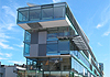


Uerdingen - walkabout through the historical city district - Part 1
City walkabout
Start: Place Am Röttgen
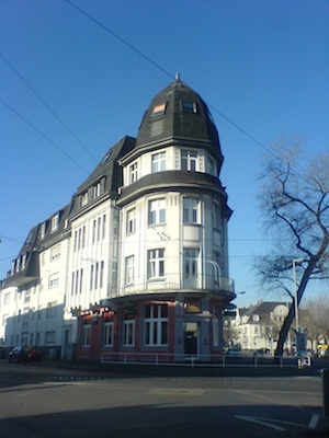
A high, distinctive building points with its pointed form to the entrance of Uerdingen's old town.
The monumental Burghof (castle yard) between Alte Krefelder Str. 10 and Am Röttgen was built in 1911 and marks this street crossing with its rounded corners and high and towering tent roof as an important urban architecture. Where the funnel shaped is narrowest in earlier times stood the Bruchtor (gate) near the house Alten Krefelder Str. 23 with its Art Nouveau motifs.
On the opposite side, Alte Krefelder Str. 4 - 6, stands the Brempter Hof, which is plastered in line with Classicism . Through the archway you reach the quiet garden. Built in the 14th century, the mansion was named after Tillmann von Brempt, an Amtmann appointed by the Kurfürst of Cologne, who was the owner of this debt free property. The oldest part of this of this mansion, which has been converted and extended many times in the past, is the Gothic gate tower. Since 1937 this mansion has been the property of the city of Krefel and the Uerdinger Heimatmuseum (local history museum) has been located in the wing building since 1981.
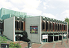
The museum, which exhibits many details concerning the economic history and structural development, is open to visitors every Tuesday and Wednesday from 10am to 12pm as well as after appointment.
Following the walk about it is worth looking into the branching small alleyways
(Obere and Untere Mühlengasse), which allows you to feel the previous narrow streets of the inner city.
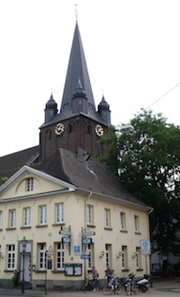
At the crossing Alte Krefelder Straße/Oberstraße the way leads along the market place to the Oberstraße. The Catholic church St. Peter becomes visible due to an interruption of the row of houses -
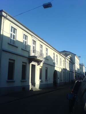
Along the Oberstraße you find plenty of two story houses originating from the oldest building times in Uerdingen, 19th century and the change of the centuries.
Onwards going you enter the funnel shaped place in front of the former Obertor (gate). At the today's place of the car park the inner moat and the drawbridge were located.
The gate was demolished in 1877 and it was used last as a prison.
On the right side you find the embankments. The lower part marks the former function as a water moat in front of the city wall stemming from the medieval times. The geometrically designed park facility built based on the planning of the gardening inspector Ernst Rocholl presented pergolas and wells. Opened in 1910. In 1928 a war memorial was added. If you cross the embankment garden a little in the westerly direction, you reach the round and five stories high Eulenturm (owl tower), the Südwestturm (south west tower) of the former city fortification. The brick tower was built from 1325 until 1330 and has at the basement a thickness of the wall of 1,5 m, which is decreasing on the way up. This tower served initially as a prison, and thereafter until assumingly 1795 as a mill. Behind the tower and the city wall the Josefs-Hospital is located. At and after the turn of the century mostly wealthy industrialists resdided in splendid villas on the other side.
If one continues the walkabout in easterly direction you will pass the Mariensäule, which was erected in 1799 after a dangerous ice drift in the city. The previous wooden monument was replaced with a stoned made one in 1894.
On the right side of the Burgstraße 21 a, you see the corner villa of the industrialist Wilhelm Dickmanns, which was built in 1909 by the architects Girmes & Oediger in a Heimatstil (local history style).
If you turn a little in the southerly direction into Dammstraße, you will stand in front of the house Rheinhorst, Dammstr. 4 - 6.


